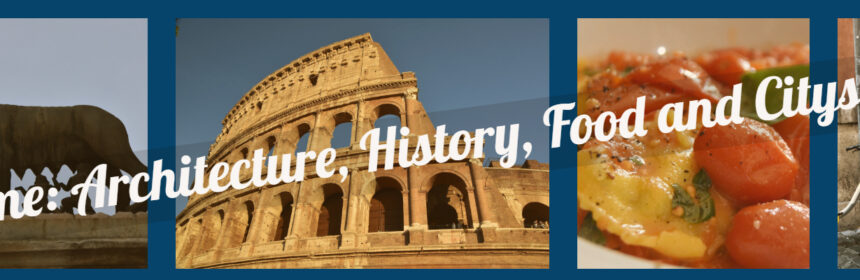
Rome: A Historical Perspective

Back to Rome

“Rome wasn’t built in a day”. Literally!  If you browse through thousands of Roman history books and a vast ocean of documented literature, you will find a city that went through ups and downs, a society that saw more change than any other comparable one, empires and republics reaching their zeniths only to be drawn to ashes. Strolls around the modern metropolis of Rome would paint the same picture. To the more inspired, you can hear hoofs of Cesar’s horses on cobblestone roads, or clanging of swords in the Colosseum, or whispers of common folk in the Roman Forum.


Early Days

Legend has it, that the twin brothers Romulus and Remus, raised by a she-wolf founded

Romulus

Romulus and Remus, raised by a she-wolf

the city. Documented history of the city goes back about three thousand years to 750 B.C. when it was governed by seven kings. Kingdoms by Romans, Sabines and their struggle with the outsider Etruscans, followed by a Republican Rome established the foundation of the Roman empire. After Julius Cesar’s influential yet controversial reign in the 100’s B.C., Augustus, the emperor took reign of the empire and it grew substantially. Art, culture, military and societal prowess helped Rome become the ominous superpower in the entire Western world. Rome saw a steep decline during the first half of the first millennium due primarily to spread of Christianity and ignoble emperors like Nero, Caligula, Claudius. A weakened Rome saw barbarian attacks, mainly by Attila the Hun, and rise of the Byzantine empire.

Walk through history

Although somewhat isolated, the ruins in the center of the city, especially in Roman Forum, contains some of the key artifacts that helps to revisit the old days. From sixth century B.C. to the Byzantine age, the lives of the Romans including political, cultural and social centers of ancient Rome are depicted here. Due to absence of any signage or relevant narration, it is close to impossible for a casual tourist to fathom the significance of the ruins. From what is left of the temples of Saturn, Vesta, Antinius and Faustina, in Roman Forum, and others (especially Imperial Forum, Forum of Augustus and Forum of Caesar), if coupled with appropriate historical anecdotes, one could reconstruct the historical timelines with relative ease.

Arches, that are signatures of Roman architecture primarily erected to celebrate major victories, were built during this time. Arches of Constantine (next to the Colosseum), Settimus Severius (in Roman Forum) and Arch of Titus (in the Imperial Forum) are some of the most remarkable ones. Read about the above here.


Medieval Times

Establishing Christianity as the only religion of the country, in the Constantine era, united the country, albeit conceding some of the ruling powers to the papacy. It became the ‘Holy Roman Empire’ under the pope-installed emperor Charlemagne in the 800’s A.D. Following 500 years saw a ceaseless struggle between the papacy and feudal nobles. It was during these years, that Roman art and architecture reached their pinnacles, albeit driven by political agenda. Pristine artistry by Michaelangelo, Bernini, Raphael and Cellini still inspire awe; but the underlying propaganda to establish Church’s dominance shows the depth of the power struggle during the protestant revolution.

Walk through history

Politically treacherous times and multiple barbarian invasions, likely would have hindered construction of significant monuments during the early years of the middle ages. Rise of Christianity influenced establishment of churches and cathedrals like Trinita dei Monti (above the renowned Spanish Steps). The Capitol was also established during this time, although the main square (Square of Michaelangelo) was built much later. The Piazza’s built during the ancient times, also saw some change with Churches, Fountains and Obelisks being put in to commemorate victories or events. Each of the Piazzas (e.g. Piazza Navona, Piazza del Popolo, Piazza di Spagna, Piazza Venezia) have their own history and significance beyond their picturesque facade. But among all the sites, Pantheon, due to its usage over the ages, holds its antiquity and is probably the most important. It holds history of old pagans, translated into a church and holds plethora of tombs.


Modern Times

Modern times beginning in the eighteenth century saw the rise of the state again with Fascism taking over in the early 20th century. Establishment of the Vatican City, a walled sovereign country within the city boundaries of Rome, in 1929 through the Lateran treaty, ended the cold war between the papacy and the state. Post World War II saw mastery of Italian art take shape of cinema, the age of “La Dolce Vitta” by Fellini.

Modern day Roma is a progressive metropolis with inhabitants from all around the globe with a juxtaposition of cultures and modern amenities. On one hand, Vatican City displays the jewels of renaissance art work at the helm of Christianity, and on the other hand you can find niche designer brands like Gucci, Ferregamo and like in the Piazza de Spagna next to the Spanish steps.


Even in the modern day, the influence of the city cannot be ignored, be it from the center of the Roman Empire, to the architectural ingenuity, and being the bedrock of Christianity. As described elsewhere in this website, no matter whether you are a history buff or a casual explorer, take time to walk the ruins and understand the relevance. Your high-school history lessons on Roman history will not appear as unremarkable as it did before. Enjoy your Roman holiday!

Hawaii Volcanoes National Park

Back to Hawaii

Back to Big Island

One of the UNESCO World Heritage Sites, covering over 500 sq. miles of land covered with rock formations and fresh lava flow, Hawaii Volcanoes National Park is a heaven for Geologists. The Mauna Loa and Kilauea volcanoes are the two shining stars in this park that is criss-crossed with trails and paved roads. After entering the park, follow an offline map, or use one of the Driving Tour Smartphone Apps (e.g. Shaka Guide).

For the list of places to cover, refer to Tripadvisor or any public sites including the NPS portal (Click here for a detailed offline printable map).

We thought sharing a little bit of knowledge about Volcanoes and the park might be helpful in your next visit to the park in relating to the concepts much easily. If you are interested in learning about Volcanoes and the formation of Earth, read on.

Written by our resident Geologist co-author, Rupsa

Hawaii Volcanoes: The history and science behind it

All the Hawaiian Islands and Emperor seamount chains are part of a mantle plume system. Mantle plumes or hotspots are nothing but molten rocks (lava) that rise from deep in the earth (mostly mantle) and reaches the surface of the earth through a weak zone (could be some deep fractures). The other common examples of islands created by hotspots are Iceland, Galapagos, etc.

Mantle plumes are stationary and can erupt through hundreds of years to millions of years before going extinct. Hawaiian plume has been erupting for millions of years creating Emperor Seamount chains, followed by Kauai which is the oldest island in Hawaii. As the Pacific plate moved over the plume, it went on to create Oahu, Maui, and the rest of the Hawaiian Islands before creating the Big Island. The hotspot is under Big Island currently. As the rate of plate motion has slowed down over the years, the same part of the plate is over the hotspot for a longer period, creating the largest island in Hawaii.

There are three types of lava flow structures that are most abundant in volcanic islands like Hawaii.

  • Pillow lavas: Pillow lavas are volumetrically the most abundant type commonly found in the underwater seamounts.
  • Pahoehoe lava: If lava cools slowly and does not move too fast it forms smooth ropy lava called pahoehoe. This type of flow forms some of the common features on the surface. Pahoehoe lava is characterized by a smooth, billowy, or ropy surface.Pahoehoe flows tend to be relatively thin, from a few inches to a few feet thick.
  • A’a lava:If lava cools quickly and moves fast it can tear into pieces called A’a.  A’a flow is characterized by a rough, jagged, spinose, and generally crackly surface. A’a lava flows tend to be relatively thick compared to pahoehoe flows. A’a flows, while rocky and sharp on the top, are extremely dense underneath – producing some of the most difficult rocks to cut through. Several hikes in the National Park take you past huge boulders of dense solid A’a. It is easy to compare with Pahoehoe that tends to be in layers.

Pele’s hair and Pele’s tear: Named after the Hawaiian goddess of fire, Pele, these structures form during times of high fire-fountaining. Pele’s hair are thin filaments of stretched out basaltic glass. Pele’s tears or Achneliths are tiny droplets of lava that look like tear-drops.

sulphur-springs

Sulphur Springs abundant with Pele’s hair and tears

Researchers have found that these are formed by the same overall process from the lava fountains, depending on the velocity of the erupting lava. High velocity and strong winds favor formation of Pele’s hair. Sometimes Pele’s tears are found attached at the tips of Pele’s hairs.

Big island has multiple volcanoes both active and dormant. Three major ones are –

  1. Mauna Kea – Dormant Cinder Top Volcano, 4,205m tall. Has a steep and irregular topography compared to other similar volcanoes in the area.
  2. Mauna Loa – Another cinder top volcano at 4,170m tall, it is younger than Mauna Kea, and erupts every few years.  A series of earthquakes beneath Mauna Kea may signal that an eruption could occur within a short time, although it cannot predict the magnitude of eruption.
  3. Kilauea – In the last few years, Kilauea volcano is active and erupting continuously. Before going to Hawaii, do check the current lava flow status here. The recent eruptions are from the Halema’uma’u Crater at its summit and from the Puʻu ʻŌʻō vent in towards the east. Lava flow from Puʻu ʻŌʻō is relatively recent (30 years old) and continues to enter the ocean at Kamokuna. Although surface flows have been common in this eruption, most of the lava from the vent travels concealed in lava
    kulaeau-crater

    Kilauea Crater from Jagger Museum (shot around 5am)

    tubes until it reaches the ocean. A blowout during a 2008 eruption built a lava lake in Halema’uma’u crater, which is a remnant of a past explosion. The lava is in this crater is as light as water. The base level of the crater is unstable to the point that it rises and falls by the minute. The gaping hole through which the eruption is visible, is a direct conduit into Kilauea’s magma reserves. This crater is just a gentle reminder how active and dynamic our mother Earth really is.

The experience of witnessing rock in its bright molten state and watching new land being formed is quite a fascinating experience, if you are lucky enough to witness it. When hot lava enters the water, it bursts into pieces, building new land at the ocean edge from the fragmental material. This pile of rubble is then covered with a veneer of lava flows, forming a “bench”. Initially the bench is weak enough that it can collapse with the smallest disturbance around it. After multiple layers of such deposits and cooling of magma, typically taking several hundred years, once the bench is stable and large enough, a new island is created. After hundreds of years of depositions of lava followed by some tectonic activity (earthquake mostly) those submerged islands rose above the water and resulted in the islands the way we see them in the present. In a nutshell, that is a brief history of the Hawaiian Islands. There are multiple islands like these that are currently submerged under the ocean in the area, and in a few hundred years we will be able to see another island full of volcanic activity, south of the Big Island.

Tips Before Visiting the Park

Although there are clearly marked barriers and signs at sites, there are some common sense warnings that one MUST follow. Read on to find out the science and geology behind those hazards and why it is important to follow them for your own safety.

  • What are the Volcanic Hazards Facing you?
    • Bench collapse can cause a 100-200 feet steep drop into unknown craters
    • Rock jets & littoral fountains hurl hot lava that erratically gets sprayed
    • Steam blasts toss rocks
    • Acid fumes (Sulphur di oxide, carbon monoxide) and glass particles can irritate eyes and lungs causing suffocation and choking
    • Scalding waves burn where lava meets ocean
  • Recommendations:
    • Do not stand near the steep cliffs. This land is extremely weak and breaks off frequently; it is impossible to climb up from the crater or ocean vertically.
    • Do not go on the rocks close to a volcanic eruption. Bench collapses have killed people.
    • Do not go near the water as it can be boiling hot and likely contains sulphur fumes.
    • Move inland quickly if you hear unusual noises.
    • Please be prepared for personal hazards especially when hiking through the enormous lava fields:
      • Most injuries are not directly due to the eruption. Intense sunlight and high temperatures can lead to dehydration, heat exhaustion, or sunstroke. Air temperatures near lava flows can exceed 120°F (49°C), depending on cloud cover and wind conditions.
      • At higher elevations, wind and rain can lead to hypothermia (low body temperature). Carry sunscreen and a hat, and drink more water than you think you need.
      • Injuries from a fall are common. It is easy to break through a thin, overhanging crust of lava or trip on a crack and fall on the abrasive, glassy surface. U.S. Geological Survey (USGS) scientists always wear long pants, sturdy boots, and sometimes gloves when working near the flows. Never shorts and flip-flops!
      • Before visiting the lava field, check with Park Rangers for current conditions and for the best approach route. Park Rangers do not recommend that you attempt the hike to the coast if you are unprepared or uninformed. The area is remote, has no shade or water source, and is seldom patrolled. Also, most areas in the park has no cellphone reception.

If you are interested to find out more about Hawaiian Volcanoes there are plethora of information in the internet. Some of the sites that I personally like are:

  • USGS website in general. Their live webcam of Kilauea is quite fascinating.
  • Universities often organize field trips to the Hawaiian Volcanoes and their reports are usually easy to follow and contains lots of authentic interesting information. One of such link is here

Because of their altitude, the summits are covered in snow in winter and are usually cold and windy in the rest of the year. So, if you plan to go for star gazing, sunset viewing at the summit, or hiking up to the visitors’ center (beyond which tourists are not allowed to drive on their own) please be prepared with warm clothes unless you are used to the Polar weather!! If you go for star gazing and sunset viewing (highly recommended) with a tour company (read our experience), they usually provide parkas. However, if you are like me to whom anything below 55˚F (10˚C) is freezing please carry a pair of gloves, and wear long pants (preferably wind buster), and close toed comfort shoes are also highly recommended.

Xochimilco

                                                                                                                                         Back to Mexico
 Back to Around Mexico City

Xochimilco, one of the UNESCO World Heritage Sites, located only 30-40 minutes south of Mexico City, has a network of canals. A lazy boat ride will take you through the canals which may remind you of Venice. The Mexican touch comes in when you spot vibrantly colored boats, Mariachi singers and vendors on boats selling tacos and corn.

We got an entire boat to ourselves so we could stop and do what we please. Our guide tried explaining everything in Spanish and we understood only 50%. With that in mind, anything written below might be half correct. 😉

The painted trajinera (boat) took us around the floating town at a leisurely pace. The city Tenochtitlan (now Mexico DF) was apparently fed by agriculture from this area in pre-historic times. The charm of pre-hispanic culture still remains buried underneath the shallow waters but the modernization of the canals through engineering feats like lock-gates, etc. have kept it alive. The lazy river ride brought forth several encounters with the street vendors with whom you’d be better off not buying anything lest you be ripped severely. Some of the bridges and houses will remind the ignorant of European architecture, before being told that Europeans stole these from here.

Enjoy the ride as much as you can, before you get back to the mundane city life. This is the one hour that you’d have believed that the real pace of life can actually be this slow. To me that 1 hour seemed like an eternity, but when the tour ended, it reminded me of the times we should actually put everything else to bed and stay awake giving the brain some time back to relax.

Location Tips
GPS Address: Blvd Adolfo Ruíz Cortinez (Periférico Sur) N/A, Xochimilco, Unidad habitacional aztlán, 16034 Ciudad de México, CDMX, Mexico
Once in the city, you will find multiple places offering Boat Rides. But go to the above address, and find parking. Parking rates range from MXN $40 to MXN $50 for the entire stay. Official rates for boat rides are MXN $350 per person. But the folks in the Embarcadero will offer different tours at random prices. Bargain shamelessly until you get them at $350 per person per hour or lower.

Check out our Photo Gallery Here


Quebec City, QC

Back to Canada

A mere 2.5 hours east of Montreal, this capital town of Quebec City province offers a plethora of options to be entertained and mesmerized. An utterly French speaking town, where nas parle Francais may cause overwhelm, at least in the local shops and food stalls. But before even entering the city, we went to visit the beautiful Montmorency Falls, about 15 minutes north of the city.

Montmorency Falls:

To enter the Parc de la chute Montmorency, we paid CAD12.00 and was greeted nicely by a French speaking lady. The grandeur of the falls do not surpass that of Niagara falls, but the height and the sheer volume of water pouring down dizzy heights make the view worthwhile. We were unprepared for the chill and the possibility of getting wet, but nevertheless walked along the wooden footbridge and went closer to the falls. The ~250 feet drop that is about 50 feet higher than the mighty Niagara falls was breathtaking and the power of the water cannot be explained unless experienced from 30-40 feet away.

After getting wet, we decided to take a closer look at the falls and took the cable car ride up to the falls and hiked along the paved trail to encounter the fall from closer than you’d dare to believe.

The suspension bridge above the falls is an amazing addition and probably an engineering feat. The entire volume of water, although controlled slightly, drops in two stages and flows into the Saint Laurant river which merges into the bay near by. The operating hours are sunrise to sunset, but the park partially closes during winter. I am sure the view of the falls in the winter will be fascinating.


Upper Town and Lower Town – Quebec City, QC
It was a nice warm summer afternoon when we drove back to the cute little French town of Quebec chemins of the old town would surely bring out the poet in you. The cozy sunset glow and the aroma of fuming french roast makes you dip in the romance of the moment makes time come to a stand still. But being the time bound tourists on a mission to explore the landmarks and capture them in the handheld cameras, we made our way to the visitor center through hustling streets of upper town.
The capital city of the Quebec City province is home to multiple historic sites, museums, and most importantly the nicest people around. A leisurely stroll around the upper and lower towns while listening to French chatter, street-side musicians playing melodies in their Saxophones and Grand Pianos, and clicking of hooves in the cobblestone
With the detailed map picked up from the visitor center, and our scratchy French, we navigated the maze-like streets to multiple attractions. This city is a paradise for the avid history lover. With French written all over, it boasts a 400 year old history which by no means compares to any European city. But nevertheless it is one of the oldest of the North American cities. Although the charm of the city may distract you to enjoy music and french ice-cream time and again, we recommend the following as a must visit:

  1. Fairmont Le Chateau du Frontiac: Built by the Canadian-Pacific railroads in the late 38171-img_0111
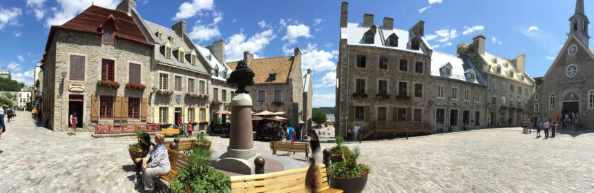
1800’s, this chain of hotels were on major stops on the rail tracks to the western coastline. This specific hotel is one of the biggest landmarks of the city and can be seen from afar as it is situated on a hill next to the Saint Laurant river. It is where arguably the most historic meeting of World War II between Winston Churchill and Franklin D. Roosevelt was held in 1944.
    2. La Citadelle de Quebec: Also called the Citadel, it housed the active military regimen of the monarch of Canada and the Governor General. With stunning views of the city and historic landmarks, a walk along the two city gates is a must for the history enthusiasts and casual tourists alike.
    3. Plains of Abraham: This is where the historic seven years’ battle between the French and the British army and navy took place in 1700’s.
    4. Hotel du Parlement: The current parliament house houses major artifacts from the 400 year history. The free 30 minute tour is a worthwhile investment to learn about the intricate details of the history of the city.
    5. Musee de la Civilization: After taking in all the history you can find in the city, top off with the well articulated displays in the museum to relate the historical events that built the city. Starting from the French invasion to replace the aboriginals in 1500’s to the modern establishment of the Quebec City in 1869, the visitor will be well versed with the city history.
    6. Battlefields Park and fortifications: Fortifications and canons everywhere in the city sings the songs of the numerous battles fought here. A walk along the edges of the upper town while dwelling on imaginary war visuals boggled my mind.
    7. Old Town: Winding alleys of old town, exquisite local artwork, and cobblestones streets d84fc-img_0099are going to make you believe that you are in the other side of Atlantic. Be sure to click pictures, but do not forget to experience the charm of the area by visiting local shops and sink in the culture.

Food Scene and Nightlife:
No points for guessing how rich offerings in terms of restaurants a classic French town would have. Being the foodies we are, we managed to find some of the exquisite food options in town for all meals. Here are some key places we tried out and were mesmerized by each:
1. Chez Boulay – bistro Boreal: Has to be one of the best Nordic meals we have had. Confit Goose and Duck, and the Arctic Char were amazing. Be sure to get a reservation or get in before 7pm to avoid wait. Check Yelp reviews here.
2. Cochon Dingue – French breakfast/brunch place in lower town near the Ferry terminal. We had the french toast, and Salmon Confit benedict from the Dejeuner menu and enjoyed every bite of them. Yelp has reviews and recommendations for your aid, but if you can afford to spend some time to have brunch or breakfast check it out.

We are always up for exploring local pubs and bars to feel the local culture and experience the nightlife. So we walked a mile away from the touristy places and found a nice Karaoke bar in the city center. La Ninaksi du Faubourg did have a fantastic atmosphere with locals coming in and singing away. Beer list was exhaustive with local breweries featured in the draft. We enjoyed some melodious French songs and sang along while sipping some old school Canadian Whiskey. I am still humming some of the songs I learned there, and do recommend paying a visit if you are in town.

Accommodation:
We ended up staying in Levis, QC on the other side of the river. It is an easy ferry ride from the Quebec City ferry terminal and it costs about CAD 14 round trip for two. Our hotel in Levis – Four Points Sheraton was located close to the Levis ferry terminal too, and had ample parking space and upgraded interiors.

Additional Tips and Info:
Wi-fi: Every tourist’s worst nightmare these days is lack of data in their smartphones. QC definitely solves the problem, and along with other amenities displays how welcoming the city is to tourists. Every pub, restaurant has free wi-fi, and on the streets one can get into the city wi-fi network easily.
Restrooms: Many clean and safe public restrooms are located in the nooks and crannies of the city.
Language: It helps if you parlez Francais but no one frowned at us if we said je ne pas parle Francais. We were astonished by the locals’ ability to switch between French and English so swiftly and needless to say how courteous people are in this city.
Driving: Everyone drives in the right lane, and moves to the left lane only for passing. To an American driver, it is a sight from another planet. What a place!


Gallery:


View of Saint-Laurant river from Upper Town

Chateau du Frontiac lit up in the evening

FDR statue in front of La Citadelle

Chateau du Frontiac stands tall

Old Town – Rue du Petit Champlain

City artwork in lower town

Rue Cul De Sac

Local Artwork

General Post Office

Cobblestone Chemins in old town

Hotel du Parlement

Old Town

Fontaine de Tourney

Summer evening in Lower Town

View from Battlefields Park

Fairmont Le Chateau du Frontiac